The Side, Burns Tavern (The Empress)
The Side, Burns Tavern (The Empress)
HER Number
6687
District
Newcastle
Site Name
The Side, Burns Tavern (The Empress)
Place
Newcastle
Map Sheet
NZ26SW
Class
Commercial
Site Type: Broad
Eating and Drinking Establishment
Site Type: Specific
Public House
General Period
POST MEDIEVAL
Specific Period
Post Medieval 1540 to 1901
Form of Evidence
Documentary Evidence
Description
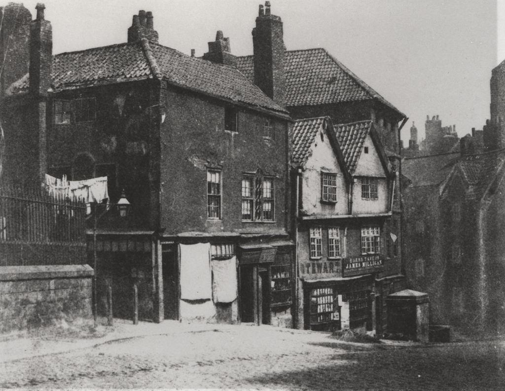
The Side, Burns Tavern
At the head of The Side. Two dominant gables on the front. Second floor windows differ beneath each gable. The right hand side window has a prominent elongated lintel. The bottom of the second floor has a jetty, and the ground floor two shop frontages. In a drawing by ?Matthew Reed in 1870, the left hand side of the building is known as Burns Tavern.
At the head of The Side. Two dominant gables on the front. Second floor windows differ beneath each gable. The right hand side window has a prominent elongated lintel. The bottom of the second floor has a jetty, and the ground floor two shop frontages. In a drawing by ?Matthew Reed in 1870, the left hand side of the building is known as Burns Tavern.
Easting
424995
Northing
563966
Grid Reference
NZ424995563966
Sources
Photograph, Newcastle Local Studies Library; Ordnance Survey Second Edition of 1896; Bennison, Brian, 1996, Heady Days - A History of Newcastle's Public Houses, Volume One, The Central Area, p 43