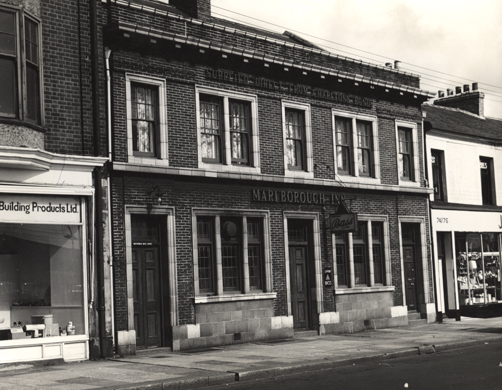
Scotswood Road, Marlborough Inn
Scotswood Road, Marlborough Inn
HER Number
10218
District
Newcastle
Site Name
Scotswood Road, Marlborough Inn
Place
Newcastle
Map Sheet
NZ26SW
Class
Commercial
Site Type: Broad
Eating and Drinking Establishment
Site Type: Specific
Public House
General Period
POST MEDIEVAL
Specific Period
Victorian 1837 to 1901
Form of Evidence
Extant Building
Description
Shown on Ordnance Survey second edition. Survived the new road layouts in the 1960s to Redheugh Bridge. Became Rockies Disco in 1986 then Secrets in the early 21st century.
Easting
424210
Northing
563590
Grid Reference
NZ424210563590
Sources
Shown on Ordnance Survey Second Edition of 1896; Bennison, B, 1998, Lost Weekends, A History of Newcastle's Public Houses, Vol 3, The West