Sandgate, The Swirle
Sandgate, The Swirle
HER Number
10474
District
Newcastle
Site Name
Sandgate, The Swirle
Place
Newcastle
Map Sheet
NZ26SE
Class
Transport
Site Type: Broad
Road Transport Site
Site Type: Specific
Alley
General Period
MEDIEVAL
Specific Period
Medieval 1066 to 1540
Form of Evidence
Structure
Description
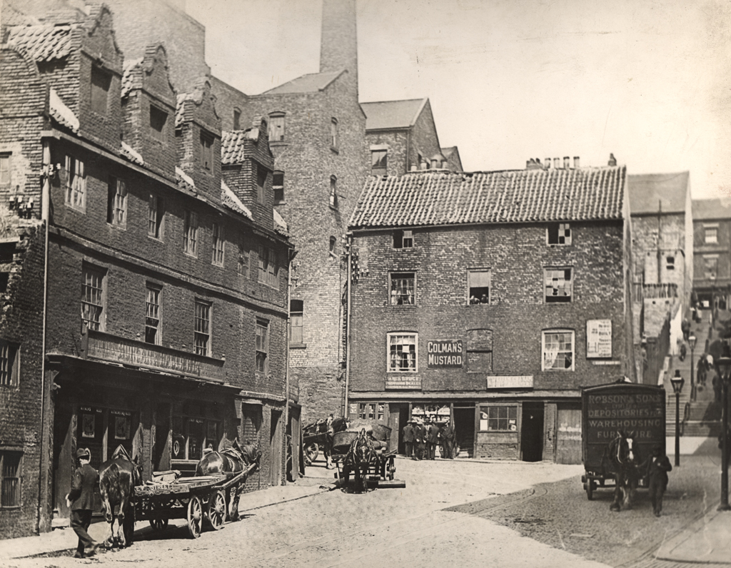
Small lane between Sandgate and the Quayside. Shown on Hutton's map of 1770 as 'Swerle'. The street name was derived from the stream, the word 'swirle' meaning the meandering of a stream of water. The 66th boundary stone of the borough of Newcastle stood at the north-west corner of the Swirle. Bourne records that the street was sometimes known as the Squirrel. There was a fine block of old buildings in the Swirle with Queen Anne gables, tall chimney stacks and dormer windows. One of them was the Half Moon Tavern.
Easting
425760
Northing
564120
Grid Reference
NZ425760564120
Sources
W. Gray, 1649, Chorographia; H. Bourne, 1736, The History of Newcastle upon Tyne, p 154; B. Harbottle and P. Clack, 1976, Newcastle upon Tyne - Archaeology and Development in D.W. Harding (ed), 1976, Archaeology in the North; W. Collard and M. Ross, 1842, Architectural and Picturesque Views in Newcastle upon Tyne; J. and J. Leslie, 2002, Bygone Quayside and the Chares; Charles Hutton, 1770, A Plan of Newcastle upon Tyne and Gateshead; W.H. Knowles and J.R. Boyle, 1890, Vestiges of old Newcastle and Gateshead, pp 86-90