Forth Street
Forth Street
HER Number
15053
District
Newcastle
Site Name
Forth Street
Place
Newcastle
Map Sheet
NZ26SW
Class
Transport
Site Type: Broad
Road Transport Site
Site Type: Specific
Road
General Period
POST MEDIEVAL
Specific Period
Hanoverian 1714 to 1837
Form of Evidence
Documentary Evidence
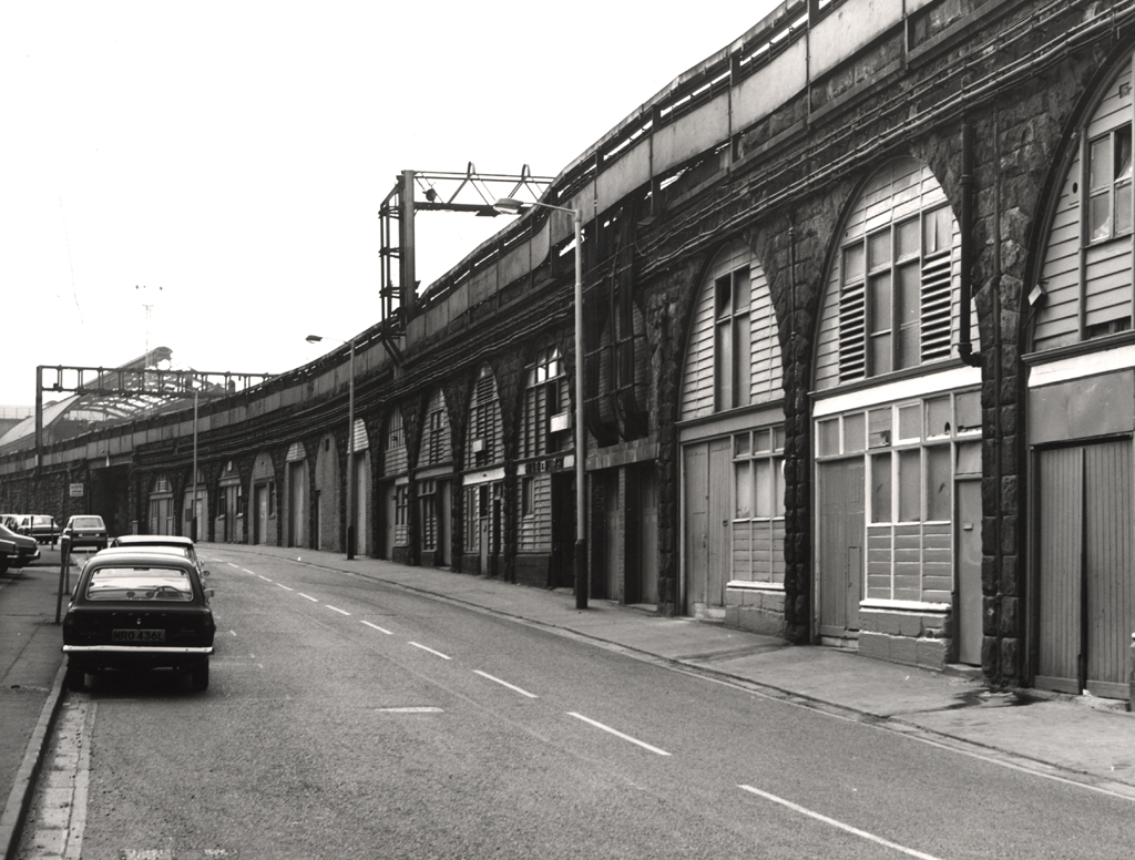
Description
Forth Street was laid out 1811as an extension of the medieval street called The Postern to link to Forth Banks. 'The Road to it [the Forth] had also been made considerably better and in April 1811 the small Postern Gate (HER 1515), with the Wall (HER 1514) etc above it, which here was of considerable height, were taken down and an opening made which greatly added to the beauty of the walk from Westgate Street by a prospect of Waldies House, in lieu of the old Ruinous Wall' {La Melange, Society of Antiquaries of Newcastle upon Tyne}. Its original line (shown on Wood 1827, Oliver 1830 and OS first edition of 1859) was north of its present position. It was moved south before 1896 as a result of the widening of the railway viaduct for the Newcastle York and Berwick Railway.
Easting
424490
Northing
563660
Grid Reference
NZ424490563660
Sources
PLB Consulting Ltd with Northern Counties Archaeological Services, 2001, The Stephenson Quarter, Newcastle upon Tyne - Conservation Plan and Archaeological Assessment; J Wood, 1827, Plan of Newcastle upon Tyne and Gateshead; Thomas Oliver, 1830, Plan of the Town and Country of Newcastle upon Tyne; Ordnance Survey First Edition 1859