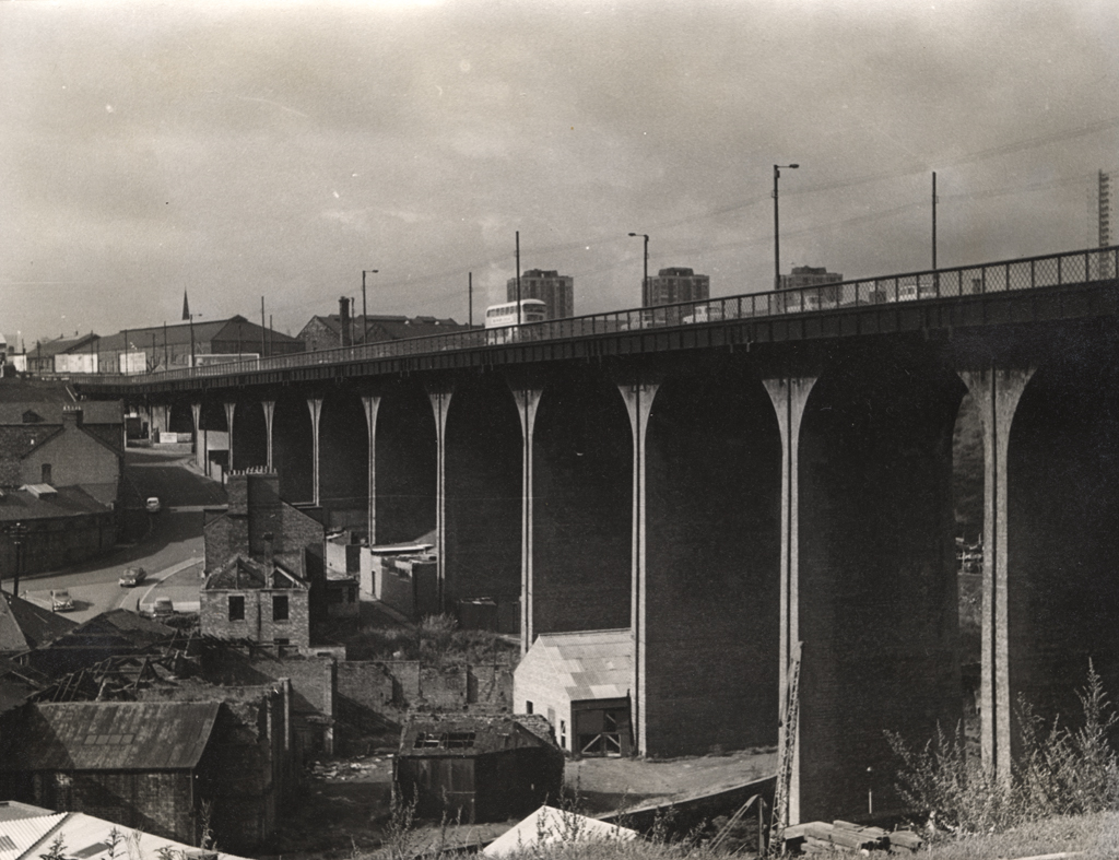
Byker Road Bridge
Byker Road Bridge
HER Number
1945
District
Newcastle
Site Name
Byker Road Bridge
Place
Byker
Map Sheet
NZ26SE
Class
Transport
Site Type: Broad
Road Transport Site
Site Type: Specific
Road Bridge
General Period
POST MEDIEVAL
Specific Period
Victorian 1837 to 1901
Form of Evidence
Structure
Description
Constructed in 1878 to overcome the need to descend and ascend the steep sides of the Lower Ouseburn Valley. 1878 for pedestrians, 1879 for raod traffic. A toll was charged for its use until 1895. Cost ÂŁ50,000 to build. Originally a toll bridge. Purchased by City Council in 1890 for ÂŁ107,500. Between 1878 and 1895 a toll of half a penny was charged for use of the brick bridge. Toll lifted 1895. In 1899 the bridge was widened from its original width of 9m to 15m.
Easting
426260
Northing
564640
Grid Reference
NZ426260564640
Sources
<< HER 1945 >> I. Ayris & S.M. Linsley, 1994, A Guide to the Industrial Archaeology of Tyne and Wear, p 19; Grace McCombie, 2009, Newcastle and Gateshead - Pevsner Architectural Guide, p 136