Cleadon, Quarry
Cleadon, Quarry
HER Number
2399
District
S Tyneside
Site Name
Cleadon, Quarry
Place
Cleadon
Map Sheet
NZ36SE
Class
Industrial
Site Type: Broad
Mineral Extraction Site
Site Type: Specific
Limestone Quarry
General Period
POST MEDIEVAL
Specific Period
Victorian 1837 to 1901
Form of Evidence
Documentary Evidence
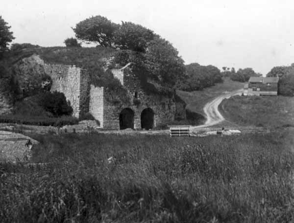
Description
Cleadon Quarry. The precise extents of the site are unclear on the 1st edition Ordnance Survey plan, which shows a Lime Kiln within the site.
Easting
438450
Northing
563980
Grid Reference
NZ438450563980
Sources
<< HER 2399 >> 1st edition Ordnance Survey Map, c.1855, 6 inch scale, Durham, 4; Northern Archaeological Associates, 2015, The Cleadon Village Atlas