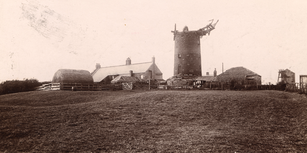
Cowgate, Windmill (Corn)
Cowgate, Windmill (Corn)
HER Number
4075
District
Newcastle
Site Name
Cowgate, Windmill (Corn)
Place
Cowgate
Map Sheet
NZ26NW
Class
Industrial
Site Type: Broad
Power Generation Site
Site Type: Specific
Windmill
General Period
POST MEDIEVAL
Specific Period
Victorian 1837 to 1901
Form of Evidence
Documentary Evidence
Description
Cowgate Windmill (Corn) is marked on the 1st edition Ordnance Survey plan, but is not shown on the 2nd edition plan, indicating that it was probably out of use by 1895.
Easting
422371
Northing
566201
Grid Reference
NZ422371566201
Sources
<< HER 4075 >> 1st edition Ordnance Survey Map, 1864, 6 inch scale, Northumberland, 97