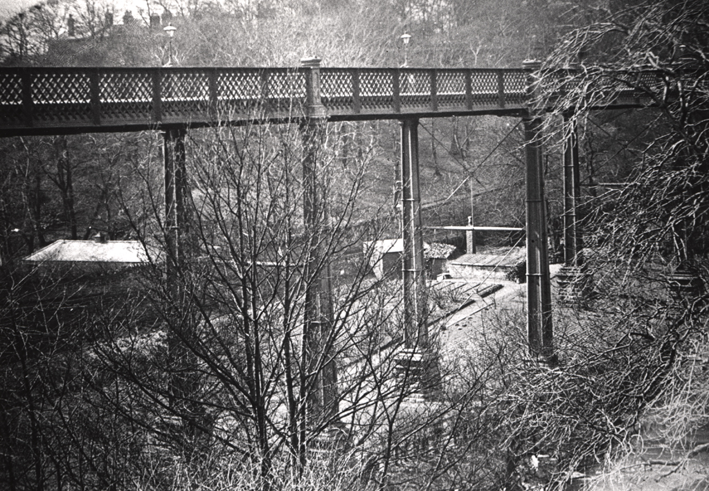
Armstrong Bridge
Armstrong Bridge
HER Number
4332
District
Newcastle
Site Name
Armstrong Bridge
Place
Jesmond
Map Sheet
NZ26NE
Class
Transport
Site Type: Broad
Road Transport Site
Site Type: Specific
Road Bridge
General Period
POST MEDIEVAL
Specific Period
Victorian 1837 to 1901
Form of Evidence
Structure
Description
Armstrong Bridge was built between 1876 and 1878, opening on 30th April 1878 to replace the crossing of the Ouseburn via Benton Bank. The greater part of its cost was met by Lord (then Sir William) Armstrong, and he and his works at Elswick were responsible for its design and the construction of the ironwork. The bridge has 8 wrought iron girder spans, supported by 7 pairs of wrought iron columns with sandstone piers and abutments. Its unique feature is its use of rocker and sliding bearings, and separate girder support to compensate for possible mining subsidence and thermal distortion. It stands 65 feet (20 metres) above Jesmond Dene and has a total length of 552 feet (168 metres). Repairs were undertaken in the early 1980s and 1993/4, including replacement of the columns with steel replicas. LISTED GRADE 2
Easting
426320
Northing
566130
Grid Reference
NZ426320566130
Sources
<< HER 4332 >> 2nd edition Ordnance Survey map, 1899, 6 inch scale, Northumberland, 97, NE
I.M. Ayris, & S.M. Linsley, 1994, A Guide to the Industrial Archaeology of Tyne and Wear, p.18
M. Bussell, 1984, The Armstrong Bridge, For In Trust magazine
W.K.V. Gale, 1979, Armstrong Bridge, Jesmond Dene, Department of the Environment
D.R. Pigg, 1980, Lecture on the Armstrong Bridge, Presented to Brunswick Mens Club 17.6.1980; Newspaper article about the opening of the bridge 1 May 1878, Newcastle Local Studies Library, Jesmond Miscellaneous Articles, Vol 1, p 46; Michael Bussell of Ove Arup and Partners, in Tyne and Wear Industrial
Monuments Trust In Trust Issue No. 12, November, 1984; John Penn, 2009, The Enigmatic Architect: Frank West Rich (1840-1929), Archaeologia Aeliana, 5th Series, Vol XXXVIII, pp 139-149