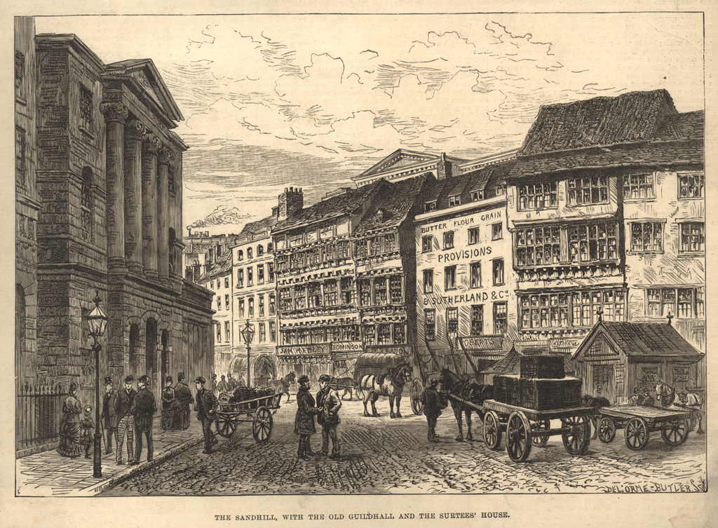
Sandhill
Sandhill
HER Number
6576
District
Newcastle
Site Name
Sandhill
Place
Newcastle
Map Sheet
NZ26SE
Class
Transport
Site Type: Broad
Road Transport Site
Site Type: Specific
Road
General Period
MEDIEVAL
Specific Period
Medieval 1066 to 1540
Form of Evidence
Structure
Description
Linked The Close to The Side. The Sandhill was so-called because it was formerly a hill of sand when the tide was out. Reclaimed by gradual piecemeal dumping from 12th century to 15th century. When Sandhill emerged in this process is unknown. The straight east side may not be the original layout. There is documentary evidence to show that the east side existed in some form from at least the 13th century. By 15th century Sandhill was the area of the town for town government and where trade and business was transacted. By 16th century and 17th century some of the leading Newcastle families lived here - Cock, Jennison, Mitford, Anderson, Davidson etc. Wealthy merchants had grand houses (such as Cosyn's House HER 1571 and Bessie Surtees House HER 5457). Gray describes Sandhill as a market for fish and other commodities including herbs, bread and leather, convenient for merchants who make their living by shipping. Here the river was navigable, there is a long quay of wharfs where ships could unload their cargoes. Boats presumably were beached and unloaded onto the foreshore and in the estuary of the Lort Burn before these jetties and quays were built. There were two cranes at the wharfs for lifting heavy commodities. In the market place there were many shops and stately homes for merchants. The town-court or guildhall (HER 4874) also stood in Sandhill (rebuilt after the Civil War as were many of the neighbouring houses). Under the guildhall was a common weigh house. Above the gate into the guildhall was clocktower. Near the weigh house was the town-house where the clarke of the chamber and chamberlains received revenues for coal, ballast, salt, grindstones etc. Next to the town-house was the Maison Dieu (almshouse) (HER 4871) and next to this the bridge chapel (HER 311). Bourne mentions effigies of King James II (1685-88) which stood in Sandhill - an equestrian statue cast in copper, the horse stood on hind-feet, on a pedestal of white marble surrounded by iron railings. It cost the town 1700 l. Gone by 1736. Part of the east row was rebuilt at various times in the 18th century. Photographs show brick buildings, up to 4 storeys in height with sash windows, standing between the earlier timber-framed houses. These were rebuilt as offices and banks in the late 19th century.
Easting
425130
Northing
563810
Grid Reference
NZ425130563810
Sources
W. Gray, 1649, Chorographia, pp 16-17; H. Bourne, 1736, The History of Newcastle upon Tyne, p 25, 60, 89, 92, 123, 124, 125, 126, 130-1; E. Mackenzie, 1825, An Historical, Topographical and descriptive View of the County of Northumberland; W. Collard and M. Ross, 1842, Architectural and Picturesque Views in Newcastle upon Tyne, pp 26-27; Jack and John Leslie, 2003, Down our streets - Newcastle's street names explored, p 7; Grace McCombie, 2009, Newcastle and Gateshead - Pevsner Architectural Guide, p. 105-107; Malcolm L Scaife, 1974, Newcastle Old and New